Assess the impact of satellite-based climate monitoring systems in managing and mitigating climate risks. What are the advantages and limitations of relying on these systems for accurate climate data?
Advancements in satellite technology significantly enhance global climate monitoring and disaster response by providing detailed, timely, and accurate data. Here’s how: Enhanced Climate Monitoring: High-Resolution Imaging: Modern satellites offer high-resolution images of the Earth’s surface,Read more
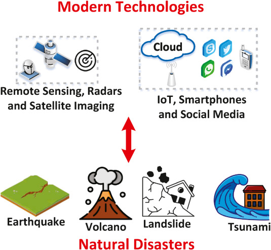 Advancements in satellite technology significantly enhance global climate monitoring and disaster response by providing detailed, timely, and accurate data. Here’s how:
- Enhanced Climate Monitoring:
- High-Resolution Imaging: Modern satellites offer high-resolution images of the Earth’s surface, enabling precise monitoring of environmental changes such as deforestation, urbanization, and ice melt.
- Advanced Sensors: Equipped with advanced sensors, satellites can measure critical climate variables such as sea surface temperatures, atmospheric composition, and greenhouse gas concentrations. This data helps in understanding climate patterns and predicting future changes.
- Long-Term Data Collection: Satellites provide consistent and long-term data, essential for tracking gradual climate changes and assessing the impact of global warming over time.
- Improved Disaster Response:
- Real-Time Data: Satellites offer real-time monitoring of natural disasters like hurricanes, earthquakes, floods, and wildfires. This enables rapid assessment of the situation and immediate response planning.
- Early Warning Systems: Satellite data is crucial for early warning systems that predict disasters such as tsunamis, volcanic eruptions, and severe weather events. Early warnings save lives by allowing for timely evacuations and preparations.
- Damage Assessment: Post-disaster, satellites provide detailed images and data to assess the extent of damage, aiding in efficient resource allocation and recovery efforts.
- Communication Networks: Satellites establish communication networks in disaster-stricken areas where terrestrial infrastructure may be damaged, facilitating coordination among response teams and aiding in rescue operations.
Overall, advancements in satellite technology enhance our ability to monitor climate change accurately and respond to natural disasters swiftly, ultimately improving environmental management and saving lives.
Satellite-based climate monitoring systems significantly contribute to managing and mitigating climate risks. *Advantages:* 1. Global coverage: Satellites provide comprehensive data on climate patterns. 2. High-resolution imagery: Detailed information on weather events, sea level rise, and land useRead more
Satellite-based climate monitoring systems significantly contribute to managing and mitigating climate risks.
*Advantages:*
1. Global coverage: Satellites provide comprehensive data on climate patterns.
2. High-resolution imagery: Detailed information on weather events, sea level rise, and land use changes.
3. Real-time monitoring: Timely data for early warning systems and emergency response.
4. Consistency: Standardized data collection ensures comparability over time.
5. Cost-effectiveness: Reduced costs compared to ground-based observation networks.
*Limitations:*
1. Data accuracy: Sensor calibration, atmospheric interference, and orbital degradation affect accuracy.
2. Spatial resolution: Limited resolution for local-scale climate phenomena.
3. Temporal resolution: Gaps in data due to orbital cycles and satellite lifespan.
4. Inter-satellite inconsistencies: Differences in sensor design and calibration.
5. Dependence on technology: Vulnerability to technological failures and obsolescence.
*Impact on Climate Risk Management:*
1. Improved weather forecasting
2. Enhanced disaster preparedness and response
3. Informed decision-making for climate adaptation
4. Monitoring of climate change indicators (e.g., sea level rise, glacier melting)
5. Validation of climate models
*Applications:*
1. Weather forecasting and warning systems
2. Climate modeling and prediction
3. Disaster risk reduction and management
4. Agriculture and water resource management
5. Urban planning and infrastructure development
*Examples of Satellite-Based Climate Monitoring Systems:*
1. NASA’s Terra and Aqua satellites
2. European Space Agency’s Copernicus program
3. National Oceanic and Atmospheric Administration’s (NOAA) GOES-R series
4. Indian Space Research Organisation’s (ISRO) INSAT and Kalpana satellites
*Way forward:*
1. Next-generation satellite constellations (e.g., NASA’s Orbiting Carbon Observatory)
2. Integration with ground-based observations and models
3. Advanced data analytics and machine learning
4. International cooperation and data sharing
5. Development of climate-resilient infrastructure
See less